Trail Webinar Questions and Answers

-Chronicle photo
Tim Barrett, at right, second from top, and Port Commissioner Shawn Brown, third from top, moderated a 24-minute question-and-answer segment, fielding questions posed by webinar participants, who could click the "Q and A" icon and submit questions as the presentations were being made. Port Commissioner Earle Marvin is at the top and contributor Dave Mahan of Whitman County Parks and Recreation is at the bottom.
DAYTON–Following the webinar presentations, a question-and-answer period of about 25 minutes was moderated by Tim Barrett, Assistant Planner at Walla Walla Valley Metropolitan Planning Organization/Sub-Regional Transportation Planning Organization (WWVMPO/SRTPO), the federally designated and state-recognized agency responsible for coordinating transportation planning activities and investments in accordance with federal surface transportation law and state statutes on growth management.
While the webinar was in progress, participants could click a "Q and A" button and write questions for this portion of the presentation.
In case a question or comments required a more-complex answer than was available during the webinar, Bennett pledged that a written answer would be provided through the Port of Columbia website in a few days.
Through May 12, additional questions and comments may be submitted via the Port website at. The link https://www.portofcolumbia.org/economic-development/touchet-valley-trail/.
Barrett, assisted by Port Commissioner Shawn Brown, addressed seven questions.
The first question was directed to Port Executive Director Jennie Dickinson: "How will the final ten percent of design be funded, if the [construction] grant covers only 90 percent?"
Dickinson said she doesn't have a "concrete answer" but in her experience, when construction funding is applied for, often the construction funding covers the last piece of design "because then you know how it's going to look in the end."
Brian Hansen, Project Engineer with Anderson•Perry & Associates, agreed that Dickinson's response was correct.
The second question was directed at Columbia County Sheriff Joe Helm: "What is the plan for public-safety access to the trail, particularly in areas that are not close to the highway or other roads? What would a call for service look like in one of those situations?"
Sheriff Helm said "I can say, as far as responding to calls for service, the Sheriff's Office will always respond within the resources that we have for any calls for service. Obviously, if there's an emergency situation, we would like the Sheriff's Office, as well as fire and rescue, to have access to the trail, but currently, I am not privy to that information or have that information provided to me."
Dickinson added that she and Helm have discussed this matter, which has also been presented to the design team. "We do want emergency vehicles to have access," she said. "Right now, if something happens on the railroad right-of-way...I don't know if people notice, but there's a lot of people walking on it. They [emergency services] can't reach them, so somehow, we would create access for them but that does not allow other vehicles access to the trail. That's the goal."
The third question was for Tim Schultz, Washington State Department of Agriculture Pesticide Compliance Program: "If a trail user makes a complaint about spraying, what does the following process for dealing with that complaint look like, and, will the farmer need to stop spraying or do anything in particular during that complaint period?"
"As far as what a normal pesticide exposure complaint could look like," Schultz said, "if someone is claiming that they were exposed to a pesticide, and they contact us, our first level of inquiry...we kind of try to triage the call over the phone to assess the immediacy of the situation.
"If they truly got sprayed by an adjacent application, which can happen and does happen," he continued, "we do address those across the state...we would ask that they find a location where we could rendezvous with one of our field staff. Since ... the closest is the Tri-Cities, it could be up to about two hours, or even more, depending on availability of staff.
"As far as having the farmer stop, that's not necessarily a requirement. The farmer, if they're continuing to make the application, we would hope that the weather conditions and their application are appropriate, which would mean that they could still continue.
"We do have a fairly significant number of complaints that come into our offices from those who may not quite understand the agricultural setting, and may have concerns about what they're seeing, or they may just be experiencing an odor, which, as I mentioned earlier, isn't necessarily an exposure," Schultz said.
A question was directed to Loreen McFaul, Executive Director of the Friends of the Centennial Trail in Spokane, a 39-mile trail that parallels the Spokane River from Long Lake to Lake Coeur d'Alene, Id., with 21 trail heads and which passes through two states and numerous governmental jurisdictions.
Q: "Can you speak to any reports of violent crimes that have happened along the Centennial Trail?"
"I'm at a loss on how to answer this," McFaul said, "because I see questions about an article that the Gonzaga Bulletin, which the campus newspaper ran about an incident in 2017. I can tell you that in terms of law enforcement on the Centennial Trail, whether that's in the City of Spokane or any other jurisdiction, law enforcement has a direct line to any 9-1-1 call, so we encourage folks on the Centennial Trail to call 9-1-1 if there's an issue, or call 3-1-1 if they see something that's not right, for illegal camping as well. The City of Spokane is handling that with a different phone number.
"I can't answer the regional crime map," she continued. "I would just say that the Logan neighborhood, which surrounds Gonzaga University, as well, a little bit west, the West Central neighborhood, or the Kendall Yards neighborhood, zip code 99205, that zip code is the poorest zip code in the state of Washington.
"What we're finding with the Centennial Trail is, at the Gonzaga area, the campus security number is the first phone number that all of the students receive at their first-day orientation, to put campus security numbers in their cell phones, and to be aware when they're on campus, or anywhere else in the region, to just be aware of their safety. How that relates to the Centennial Trail, I don't have data. I can't tell you that the police have never contacted us or the coordinating council to sit down and talk about a different kind of trail safety, or a different kind of public safety, and I've been doing this for almost ten years.
"Law enforcement, and security and safety aren't any different than any other location," McFaul said. "We encourage folks to use the buddy system and keep their eyes and ears open."
Barrett pointed out that the population estimate for the greater Spokane area is about a half million people.
A second question for McFaul: "Can you touch upon the homeless population on the trail?"
Once concern expressed among locals is the homeless/transient population becoming invasive in the community due to the trail. "With Spokane already having an established homeless community, does this pose problems along any parts of the trail?"
"Because the footprint of the Centennial Trail is along the Spokane River," McFaul answered, "that it is a fantastic for fishing, and canoeing, and kayaking, and it's a really great place for illegal camping.
"So it's very, very frustrating and a growing concern here because of the access to all of the services Spokane provides, from homeless shelters to being the post office box where monthly checks come in for that audience, and those residents receive them," she said.
"This isn't probably the time or place to answer that, but I can tell you that it is a Western U.S. issue," McFaul said. "We have seen it grow with COVID, and we're finally seeing Mayor Woodward here in Spokane really pushing the regional jurisdictions to get together and get a regional answers for homelessness, not forcing just one city over another to take it on and offer those services.
"Folks do enjoy camping on the Centennial Trail," she said. "They also enjoy camping all over, on intersections and parks and the Centennial Trail is not unique. They're in a lot of places right now, which is very unfortunate.
"And try to provide compassionate answers and connect folks with services, and understand that many people are in just dire straits, that it is not a life that anyone would necessarily choose.
"Spokane is a compassionate community and I think that's well known with this population," she said.
The question was posed Dave Mahan, Parks Superintendent/Ranger/Operations Coordinator with Whitman County Parks and Recreation, which oversees the Bill Chipman Palouse Trail, a 23-year-old trail, ten feet wide, extending seven miles between Pullman and Moscow, Id.
"The trail has been around for almost 25 years and has never had any regular negative impacts from homelessness along the trail corridor," he said. "However, in the last two or three years we have noticed one or two homeless folks a year might spend a night or two out there. It's a fairly new thing that we're seeing and a lot, most of that activity occurs near the Pullman end of the trail, so those calls are handled by Pullman P.D., if need be.
"It's a benefit for the Bill Chipman Trail that the state highway runs just about parallel to the trail, so you can just about drive from Pullman to Moscow and see the trail for the entire way," he said.
"So there isn't a whole lot of hidden, secret places for folks to set up a camp or anything like that out on the Chipman Trail," Mahan said.
A questioner pointed out that the proposed Maintenance Plan calls for weeds to be sprayed once annually, but asked if twice a year is what is needed? "The trail behind the Port has been noted to have maintenance needs that have not been met."
"Two different issues here," Dickinson answered. "The future trail spraying kind of depends on what you spray. In our industrial park, we have areas that we use more of a sterilant than a short-term weed killer, and those places do not need to be sprayed more than once a year.
"Places that we may not be able to use a sterilant may need to be sprayed twice a year," she said. "That's a good point and it will be part of our ongoing discussions.
"Regarding the trail behind the Port office," she continued, "I think it's important for people to know that I had a volunteer ask me if they could put a trail on the hillside. I was surprised. There's some old cattle trails and an old road that goes up there, but I agreed if that person wanted to work on it themself, that they could do it.
"What's happened is that the trail has become popular," Dickinson said. "So now the poor volunteers are having a hard time keeping it up, which I completely understand. Last fall, for the first time, the Port did pay to have some trimming done along the trail, and we, this year, are going to have more of a strategy for trying to keep the weeds down along the edge.
"That one took us by surprise," she said, "by how popular it's been. We did get a donation from a local business last year, a large donation that covered more than half the cost of the maintenance, but we will have to come up with a more concrete plan for that moving forward. We're very glad people are enjoying it."
Question for Brian Hansen of Anderson•Perry and Ken Van Voorhis, of SPVV Landscape Architects of Spokane: "What are some of the things that could be installed or implemented to lessen the impact of foot and general traffic on the residential homes across from the Dayton end of the trail?"
"The Dayton end of the trail is acting as a public sidewalk, almost," said Hansen. "It's a question I'll have to look into and think about: what those design potentials may be as we go through the process.
"There are different ways to treat sidewalks adjacent to residences but as we're in the City of Dayton, we'll have to take a look at that," Hansen said.
"These kinds of specific residential questions are taken care of, generally, on a case-by-case nature," Van Voorhis said. "We like to take a look at it. Currently we're working on an extension of the Centennial Trail and this exact question came up.
"The reality is that we want to look at each individual's access point and the proximity to the trail and make sure that there's plenty of visual line-of-sight, and clearances associated with that," Van Voorhis said, saying that he assumes the question is more apropos to the West Commercial Street section of the trail. Brian and I will look closely at that, and how that impacts that particular leg of the trail at the next level."
Next question: "Have you looked at alternatives to using asphalt as the trail's material? Many rails and trails in the Midwest use an alternative mix of fine gravels and Bentonite. This results in lower cost and less maintenance. Asphalt is not permeable, and if the base is not prepared properly, you will see free-thaw or root damage, and higher maintenance costs. Gravel mixes used appropriately are less expensive, easier to maintain and very rideable by all styles of bicycles. The Walla Walla Valley and the extended region has become, or has the potential to become, a premier area for cycling: low-traffic roads with interesting terrain are very appealing to the cycling community."
What are Hansen's and Van Voorhis's thoughts on using alternate materials, other than asphalt? Van Voorhis said the choice of asphalt is probably based on the local availability of product and material.
"I don't disagree that the gravel-aggregates, the fines associated with that are very manageable, in fact, the Hiawatha Trail is primarily set up of a gravel base," he said. "However, in its very rural nature, it's a little bit different. Brian and I will take a look at that in more detail, but generally, it's about the availability and the value engineering needed for what's happening in this region.
"Ken hit it on the head," Hansen said, adding "making sure the trail is accessible for all users, making sure whatever the surface may be that it's traversable by not just bicyclists and hikers, but maybe someone in a wheelchair, or someone with a disability that needs that smooth, all-surface terrain."
A question for Chipman Trail's Mahan and Clara Dickinson-McQuary, Program Specialist with Washington State Parks, about human waste and waste paper around camping areas. Has this issue been seen in your area?
"Along the Chipman Trail, no, we have not," Mahan said. "I think that has a lot to do with, as far as homelessness, we may see one or two folks pass through...we don't have an issue with any type of encampment or long-term camping, which is where I think you would generally see what's being described there.
"Our staff does a twice-a-week litter sweep," Mahan said. "We do our best to keep things picked up."
"On the Palouse to Cascade and Columbia Plateau Trail," Dickinson-McQuary said, "we only see those types of issues only in those remote locations where we don't yet have those types of services. Adding services is a really big part of that."
A question for Sheriff Helm: "You mentioned little or no complaints of loitering or vandalism along the dike trail. You did mention reports of drug activity along the trail. Is there an increased number of reports along the dike trail compared to reports of drug activity in other parts of Dayton?"
"No," Helm responded. "There are no increased reports of drug activity on the dike trail compared to other parts of the county. [Drug activity] commonly occurs county wide," he said. "It's more of a thoroughfare where, obviously, nighttime, late-night hours, it's been known to be an area of trafficking for those to avoid law enforcement. Other than that, there haven't been increase calls of drug activity compared to other areas."
-Chronicle photo
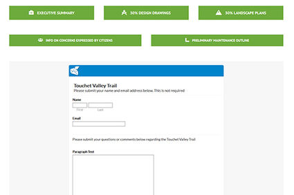
This page on the Port of Columbia website includes a form to submit questions or comments about the Touchet Valley Trail. The website address is: https://www.portofcolumbia.org/economic-development/touchet-valley-trail/.
The final question: "Why not charge a user fee for the trail, like the Hiawatha Trail, instead of expecting taxpayers to foot the bill? We have to pay for fishing, hunting and vehicle user fees."
Dickinson wasn't sure how to answer the question. "The Hiawatha Trail is pretty special from what I understand," she said.
Port Commissioner Shawn Brown stated the Hiawatha Trail has a private operator and fees are for bicycle rentals and bus transportation to support the private operator that services that trail.
"It's a wonderful, fun ride in one direction," Brown said, "because you can ride a large distance, mostly downhill. At the end of the trail, you've either bought yourself a bus ticket back, or you're going to turn around and ride uphill, or start at the other end of the trail, and ride down back."
Bennett closed by saying the Port will follow up all of the questions submitted and encouraged those listening to check the Port website in the next couple weeks for written responses to all of the questions covered during the webinar.