
Green Ridge Fire Update
-Chronicle photo
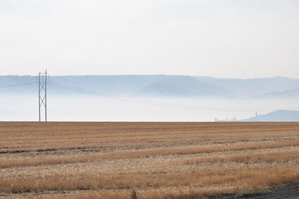
The weather forecast for the Columbia County Fair weekend calls for a 30% chance of rain showers and thunderstorms on Friday, September 10, with clearing on Saturday and Sunday with sunshine and temperatures in the mid to upper seventies-perfect fair weather. This Patit Road view of the Blue Mountains' foothills earlier this week showed smoke and haze laying in the valleys. The National Weather Service is predicting widespread haze until frontal passage on Friday, and the smoke index for Columbia County is "green" for Fair Weekend.
By Mitch Ketron
Incident Commander
Southern Area Incident Management Gray Team
DAYTON–As restrictions in the national forests are eased this week, September 7, 2021, fire officials advise the public to remain clear of firefighting areas and drive safely while in the forest.
On the Green Ridge Fire as of Tuesday, September 7, firefighters continued to knock down flare-ups that popped up, with assistance from helicopter bucket drops. In addition, firefighters continued to patrol the fire line, conduct mop-up activities, and search for hotspots throughout the fire perimeter.
Firefighters will continue to extinguish flare-ups with the assistance of helicopter bucket drops along the southwest perimeter of the fire, patrol established fire line, and conduct mop-up activities. Resource advisors are onsite to provide knowledge of cultural and natural resource areas to be protected.

The Green Ridge Fire is now 41,421 acres and is at 40% containment. There are 191 total personnel on the fire, which is located 30 miles east of Walla Walla.
The public is advised to stay clear of fire-blackened areas for the many unseen hazards that exist, including live green, fire-weakened, trees which may fall without warning, and scalding hot stump holes. Please maintain situational awareness of your surroundings when traveling and hiking in fire-damaged forests.
The public should watch out for fire crews and equipment while traveling on forest roads. Some roads remain closed with barriers. Barriers are in place to protect firefighters and the public, so please respect the closed areas.
Before going hunting, hiking or camping, be sure to check the forest, grassland or ranger district for fire restrictions or area closures. For a checklist of fire-safe actions when enjoying the outdoors, visit the USDA Forest Service at Know Before You Go.
Weather & Smoke Information: Widespread haze. Mostly sunny, with a high near 87. Southeast wind 5-7 mph becoming calm in the afternoon. Winds with gusts to 8-15 mph in the afternoon. Relative humidity will be 19-24 percent. Smoke information is available on Washington Smoke Blog at: https://wasmoke.blogspot.com/
Forest Closures: A reduced Fire Emergency Closure is in place on the Umatilla National Forest and was updated on September 2, 2021. The closure order map can be found at: https://www.fs.usda.gov/detail/umatilla/alerts-notices/?cid=stelprdb5286768
Evacuations: Level-1 evacuations (be ready, stay aware) remain in place in Garfield, Columbia and Asotin counties. For more information on evacuations, please visit your local county government web pages for full information.
Temporary Flight Restrictions: The temporary flight restriction over the Green Ridge fire has been removed. However, wildfires are a "No Drone Zone." Whenever a drone is spotted near the fire all aircraft are grounded until we can be sure the drone is clear of the area. For more information, visit http://knowbeforeyoufly.org.